
Water Balance for Natural Features
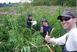
Toronto and Region Conservation Authority (TRCA) and Credit Valley Conservation (CVC) initiated a long-term research study in 2012 to better understand wetland hydrology and how urbanization drives changes in these natural systems.
Currently, our ability to achieve water balance objectives for natural features is limited by the availability of sufficient science, monitoring protocols, effective modeling, practitioner training, and adequate criteria. The purpose of this project is to advance our knowledge and understanding of hydrological requirements of natural features to protect the long-term ecological health of these features through the land development process. This understanding will lead to improved consistency, efficiency, and efficacy in reviewing urban development and permitting applications affecting the water management of natural features.
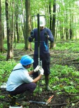
Due to the large cost and complexity of the project, the study team has decided to phase the study, with an initial focus on the study of wetlands. The intent is that other natural features, including watercourses and woodlands, will undergo detailed study in later phases. Currently, wetland hydrology is poorly understood within the Greater Toronto Area watersheds. This project is intended to gain a better understanding of wetland hydrology, and how sensitive different wetland communities are to changes in hydrology. The main goal of this initiative is to assist with future land-use planning and impact assessment, but secondary benefits may result for wetland restoration initiatives and the evaluation of the wetland integrity in the watershed.
The intent is that data will be collected over a long period (+10 years), but will be used in support of water balance analysis processes currently being undertaken for urban development and water extraction approvals in the whitebelt lands (i.e. areas vulnerable to development). The data will provide valuable information about the hydroperiod conditions associated with certain wetland communities that are both common in the whitebelt and vulnerable to hydrological changes.
The data collected in this study is being used in three key ways:
- To calibrate various water balance models to determine which models are appropriate to which applications, and how much data is sufficient to adequately represent actual wetland hydroperiods. Dr. Andrea Bradford at the University of Guelph and her graduate student are partnering with TRCA on this component.
- To allow us to better understand the hydroperiod of sensitive vegetation communities so that this information can be used as a surrogate where information is lacking, such as when inadequate lead time is available for collection of sufficient baseline data.
- Over a longer time period, an additional goal is to pair hydrological data from this project with other long-term terrestrial monitoring data to help address a number of information gaps we have with regard to wetland functioning across our jurisdictions.
This project also builds upon existing Conservation Authority regional terrestrial monitoring programs. These programs currently include study of the structure, function and composition of floral and faunal communities within GTA watersheds, but currently have very limited capabilities to draw conclusions about the hydrology within wetlands. The intent is that over time, hydrological data from this project can be paired with other terrestrial monitoring data to provide answers to a number of information gaps we have with regard to wetland functioning across our jurisdictions
.